Terrain Characteristics
Ruggedness?
What happens when you take the slope of a slope map?
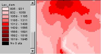
slope map,
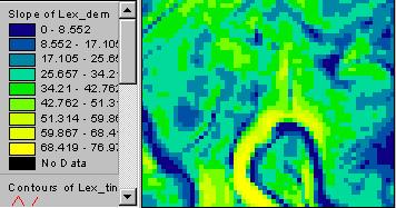
and slope of the slope map?
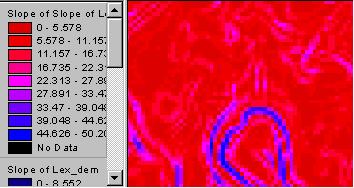
What does that mean?
Here’s a better way to look at the second derivative of elevation. Use the Curvature command in ArcGIS (GUI, Geoprocessing Toolbox or Command line). A new “Surface Parameters” tool in ArcGIS Pro uses more points and calculates the fit of a multi-dimensional curved surface. Output can be plan (tangential to the flow line), profile (along the flow line) or an average of the two.
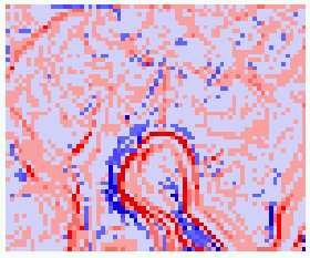 planform curvature |
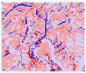 profile curvature |