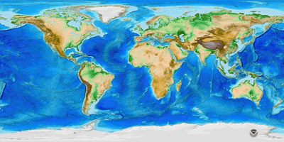
Digital Topography
Datasets differ in scale or resolution of the data.
Raster digital elevation model (DEM) data are the most common, so we’ll start there.
-
- global such as the Etopo1 dataset elevation data point every 1 arc-minute of latitude and longitude
…plus many other “global” data sets
-
- Regional Scale (3 arc second data from digitizing contours on 1:250,000 maps, 1 degree quads) data (USGS; now archived…not used much.)
Western Half of the Salt Lake City 1 x 2 degree sheet
-
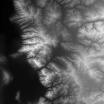
- SRTM (Shuttle radar topography mission) (formerly 3 arc-second global data, now 1 arc-second globally)
was the first global topographic dataset of earth (but long after Mars….)
example from near Mt. Cook New Zealand ( about 1/2 degree E-W)
— note the white patches (voids) where thick clouds or topographic shadows prevented transmission of the radar signal. - 1 arc second (roughly 30 m) data is available for the entire US at the National Map
https://nationalmap.gov/elevation.htmlwhich had the former National Elevation Dataset (NED) and now 3D Elevation Program (3DEP)
- SRTM (Shuttle radar topography mission) (formerly 3 arc-second global data, now 1 arc-second globally)
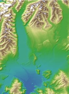
Here’s Lexington, VA 7.5 minute quadrangle as a DEM.
This dataset was assembled from a variety of sources, including digitizing contours, analysis of aerial photography, and now airborne lidar and radar projects.
A DEM raster layer is the most common DTM format
and these start out as
- In the old days, field survey points, from which a surface is interpolated via contours. We have since digitized these contours maps (1:250,000 scale or 3-arc second maps were created that way; lots of contour artifacts – 1980-90’s)
- Then air photos were used to make a stereo-model (of contours or points). Control points on the ground (benchmarks) are needed to calibrate the model (most USGS 30m DEMs started this way). again, the contours had to be digitized to make the DEM.
try parallax exercise - Then shuttle measurements using RADAR came along in the 2000’s (SRTM)
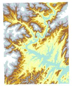
- Now LIDAR from planes is offering 1 ft grids and smaller that are interpolated from a “point cloud.”
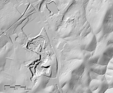
3DEP LIDAR image of the quarry on Rte 60.