We’ve seen how we can look “through” several data layers to analyze the spatial and attribute coincidence. Now how about functional relationships that concern the distance or space on the map. Here’s the first topic.
Buffers – the distance from point and line features
We can associate every location on a map with its distance to and association with lines, features or polygons. When we look for areas described by a given distance or set of distances from a feature, we are making a “buffer” of that feature. The ArcMap Buffer Tools give us the option of looking at a single or multiple distances from a point, line or polygon (see demo\buffer\buffers project and use the geoprocessing tool).
Here are single and multiple buffers of some stream segments near Lexington. Imagine needing them for water quality control, or to study groundwater interactions with streams.
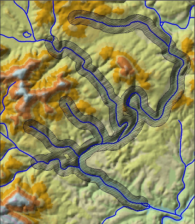 a single distance buffer (250 m) |
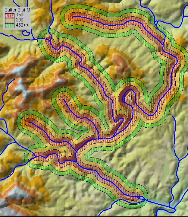 a multiple distance buffer (each ring is 150 m) |
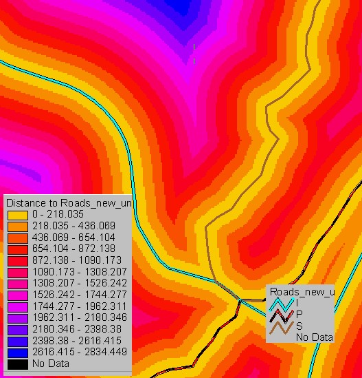
Distance Maps
If what you need is not a discrete distance from a feature, but an analysis of “how far”, then you want a surface that is a “distance map” showing the distance to a feature for every point on the map. This might come up if you were modeling pollution and need to know how far every point is from a road to determine atmospheric lead fallout. This is a GRID function in ArcMap and results in a map where every cell contains the distance to the nearest selected feature, in floating point, using the “Map Units.” Use the tool called Euclidean Distance, in Spatial Analyst toolbox. Nope. Don’t. It has been replaced by Distance Accumulation.
In the buffer project, make a new Distance layer called “dist2stream” in the 2nd map tab.
Once you have made the distance raster, you can select any distance, or group of distances, to use as a buffer (in either raster form or by converting to vector).