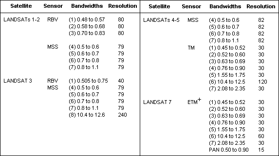
The Landsat program launched in the early 1970s and has had 9 different satellites (although the rocket carrying landsat 6 failed on launch) and 5 different sensors:
- RBV & MSS – multispectral scanner (early), visible to SWIR
- TM sensor – 7 bands 3 visible, 1 thermal IR, 3 reflected IR
- TM+ sensor – added panchromatic (15 m) band
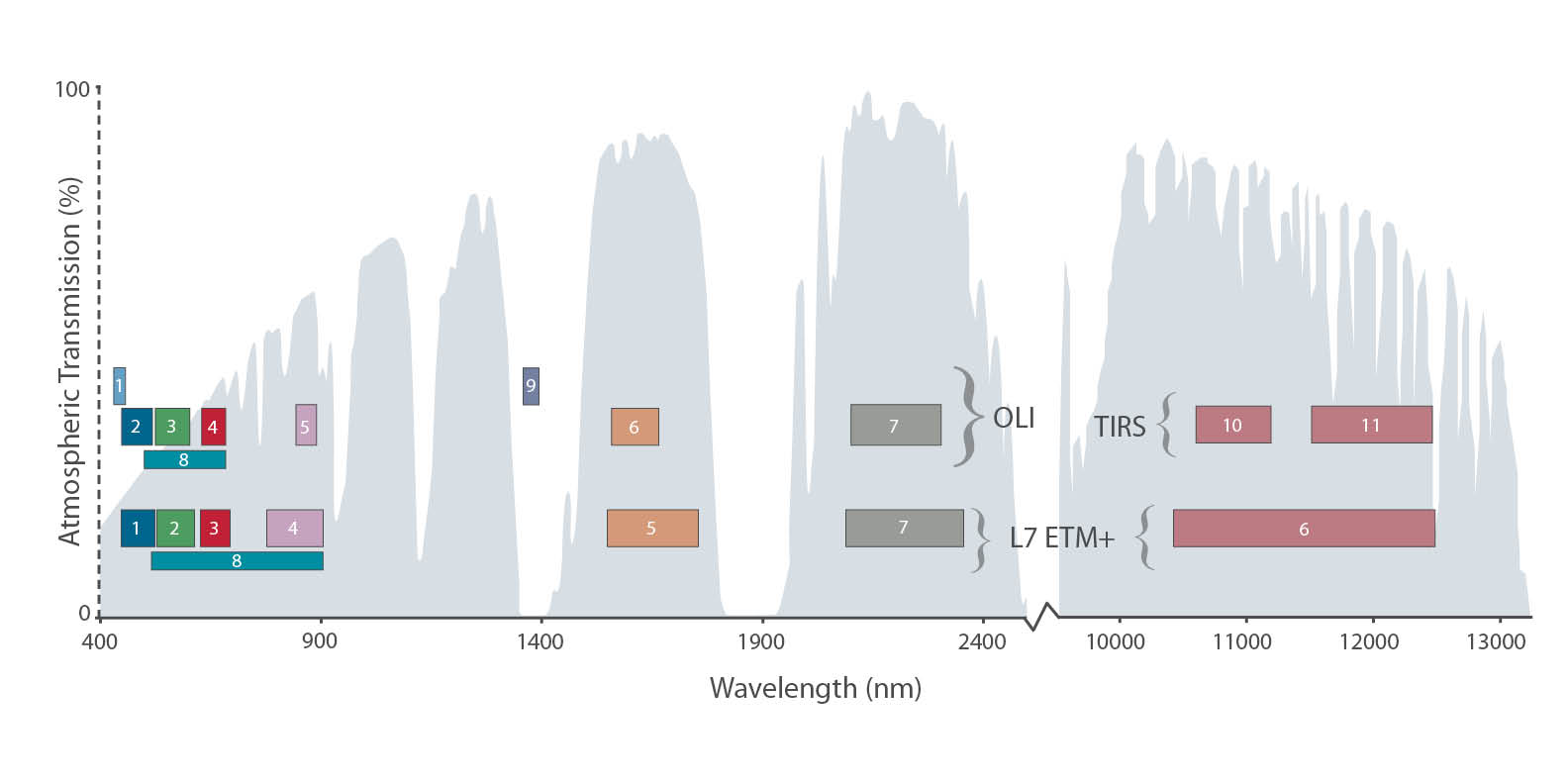
(aboard landsat 7 but Scan Line Corrector (SLC) failure in 2003 when it started collecting data in stripes instead of whole scenes) - OLI & TIRS sensors – Landsat 8, launched early in 2013, and Landsat 9 launch in 2021
– adds new IR bands, one for cirrus clouds, and a shorter-than blue coastal scanner (see image below)
– calibrated using the moon!

The Landsat 7 satellite looks like this and used a rotating mirror (that’s what failed; Landsat 8 uses a “pushbroom” approach)
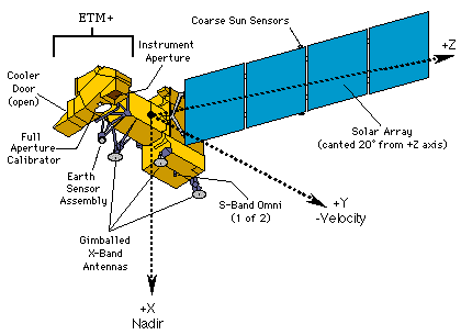
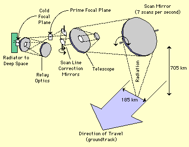
for the optic path collecting radiation from earth.
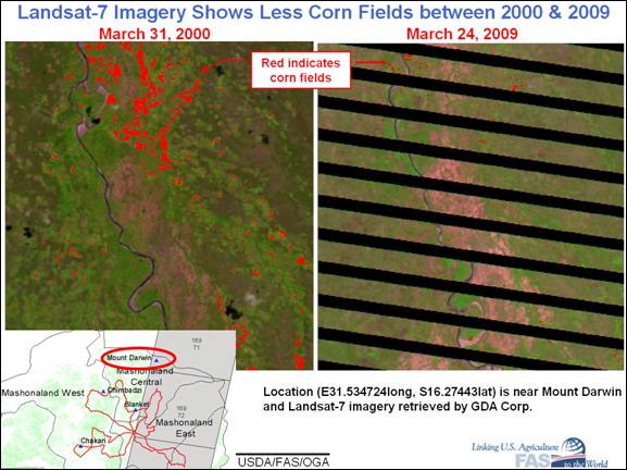
Raw data below (note packages of undistorted scan lines) and then geometrically corrected (on right)
Landsat 7 failed in 2003 and as of January 2024 is not collecting data.
Landsat data is ordered by ROW and PATH and date. Cloud cover and season are important considerations. Archived and very recent Landsat TM, ETM+, and OLI/TIRS images for anywhere in the world can be browsed and then downloaded from Landsat Look, USGS Earth Explorer (my choice), or GloVis.
Google has seamed together cloud-free images for the entire world for the history of the Landsat program (1984 to present)
https://earthengine.google.com/timelapse/
I recommend going to the rivers of Peru in the Amazon basin. Amazing.