Lidar (Light Detection And Ranging)
- What is it
- Same technology as RADAR but because it operates in shorter wavelengths (visible in NIR), can return greater detail.
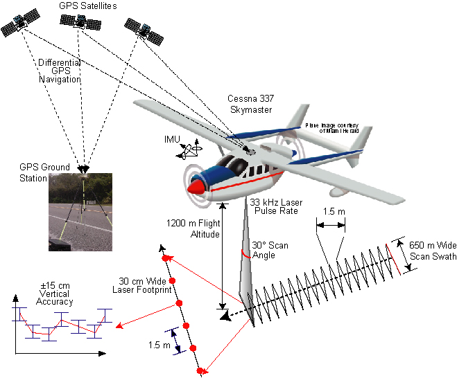
More general info here in an ESRI Story Map, which has info on processing and even a very detailed geoprocessing model at the end. - LIDAR devices are operated from ground or air based scanners.
for example
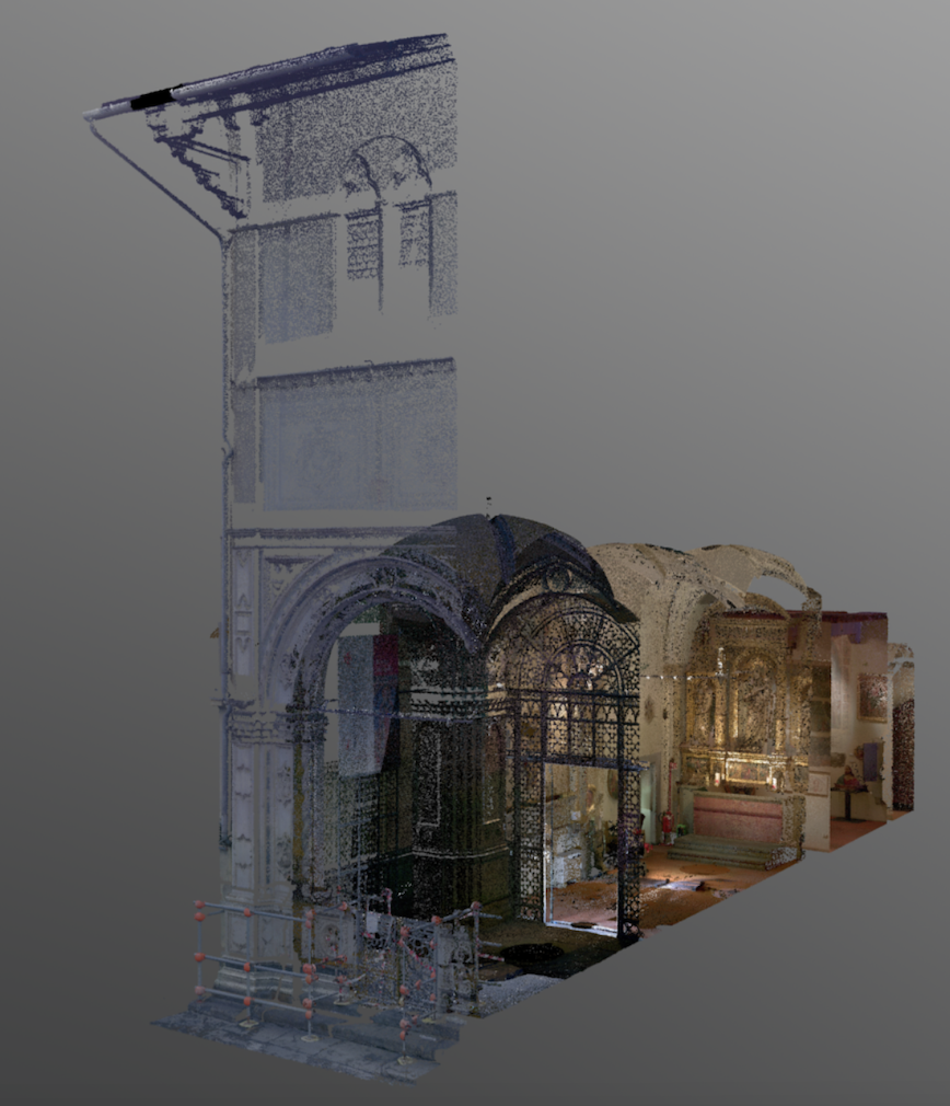
Florence As It Was
or
http://www.surfacegeology.earth.utah.edu/research/Jewell_digital_mapping.htm
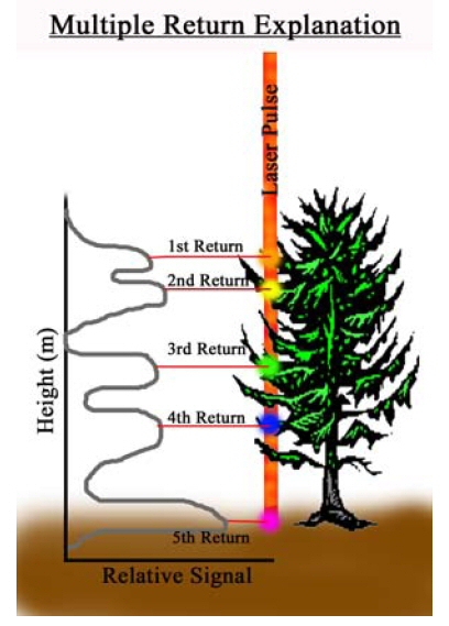
- multiple returns allow filtering of vegetation and “bare earth” based on first and last arrivals of returns.
https://www.e-education.psu.edu/geog481/sites/www.e-education.psu.edu.geog481/files/Figure_8_01.jpglets open the project in …\Demo\lidar to see how this works for a small area
- Same technology as RADAR but because it operates in shorter wavelengths (visible in NIR), can return greater detail.
- Creation of a DEM from LIDAR
forestry applications
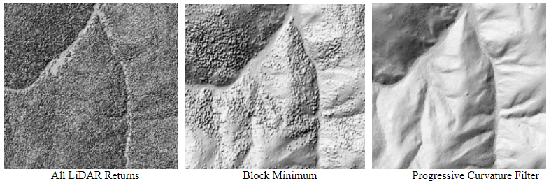
Ground detection “last return” above
or use a “progressive curvature [or morphological] filter” (https://forest.moscowfsl.wsu.edu/lidar/)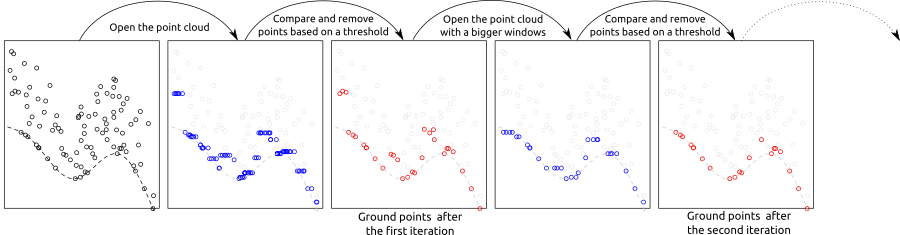
from a lidar program using r (https://r-lidar.github.io/lidRbook/gnd.html)
- Geoscience and environmental applications of LIDAR
-
- Puget Sound consortium – finding faults (http://pugetsoundlidar.ess.washington.edu/uses.htm)
Compare the “Toe Jam Hill fault scarp” image to this google maps location. - North Carolina Statewide Lidar (coastal change, floodplain maps)
- mapping landslides, sinkholes, and more in Virginia
- Puget Sound consortium – finding faults (http://pugetsoundlidar.ess.washington.edu/uses.htm)
-